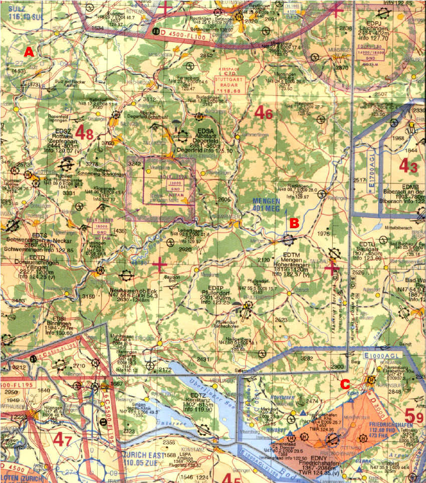
(Refer to Jeppesen VFR chart ED-6 or figure ED6-13)
Flying from A (N48° 23 E008° 39) to B (N48° 03 E009° 22), TAS 125 kt and forecast W/V 180/25.
What is the highest Minimum Grid Area Altitude (Grid MORA) on this route?
4000 ft
4500 ft
4800 ft
5900 ft