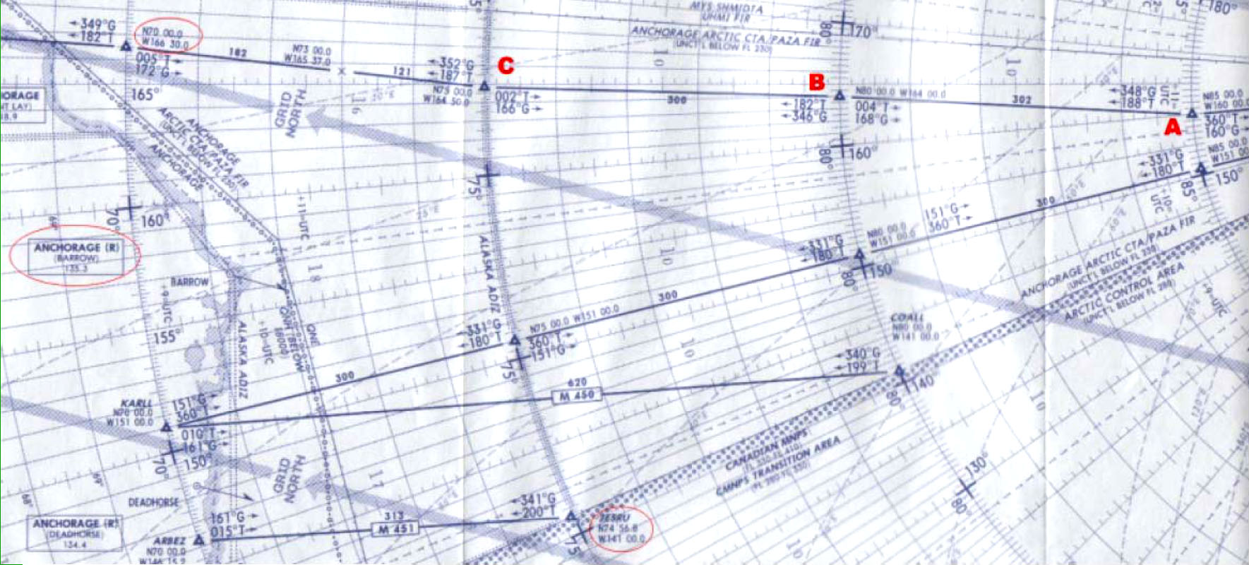
(Refer to Jeppesen chart 5AT(HI) or figure HI-44)
Assume the following route:
A (N85° 00 W160° 00) to B (N80° 00 W164° 00) to C (N75° 00 W164° 50).
The highest Grid MORA for the route is:
1000 ft
1600 ft
160 ft
1600 m
(Refer to Jeppesen chart 5AT(HI) or figure HI-44)
Assume the following route:
A (N85° 00 W160° 00) to B (N80° 00 W164° 00) to C (N75° 00 W164° 50).
The highest Grid MORA for the route is: